JacksonWeather.net
  • Home
  • Forecasts
    • Jackson
    • Humboldt
    • Dyersburg
    • Martin
    • Lexington
  • Storm Center!
  • Radar/Satellite
    • StormView Radar
    • Radar Dashboard
    • Satellite Page
  • Nat'l Maps
  • Currents
    • Union University
    • McKellar Airport
    • UT-Martin
    • Regional Observations
  • What's New?
  • About
  • Links
  • Tropical
  • Climate Resources
  • Earthquakes
  • Weather History
  • Agri-Weather
  • Contact Us!

JacksonWeather.net Storm Center

Current Mid-South Radar Loop

Note: StormView Radar currently does not display severe weather warnings. This will be resolved in the near future.


Mid-South Hazardous Weather Outlook

NEW! Graphical Version 

Text Version 


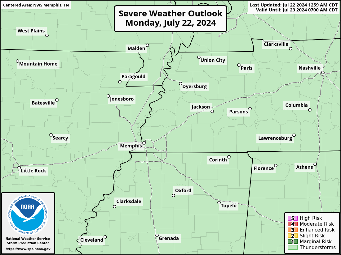
Storm Prediction Center Convective Outlooks

SPC Convective Outlook - Day 1
SPC Convective Outlook - Day 3
SPC Convective Outlook - Day 2
SPC Convective Outlook - Days 4-8
Click image to view entire convective outlook on the SPC website (new window).

JWN Interactive Warning Map

JWN Warning Map

Lake Obion Weakley Henry Dyer Gibson Carroll Benton Decatur Lauderdale Crockett Tipton Haywood Madison Shelby Fayette Hardeman Chester Henderson McNairy Hardin DeSoto Marshall Benton Tippah Alcorn Prentiss Tishomingo Tunica Tate Lauderdale Colbert Pemiscot Dunklin Mississippi Clay Greene Craighead Poinsett Cross St. Francis Lee Crittenden Butler Stoddard New Madrid Scott Ripley Wayne Mississippi Stewart Houston Humphreys Perry Wayne Fulton Hickman Carlisle Graves Calloway Marshall Trigg Lyon McCracken Ballard
LEGEND
Warning Map legend


Latest Severe Storm Reports from NWS-Memphis


Home

Radar

Storm Center

About

Contact

Copyright © 2010-2023 Cirrus Weather Solutions, LLC - All Rights Reserved